
A taste of winter in early April

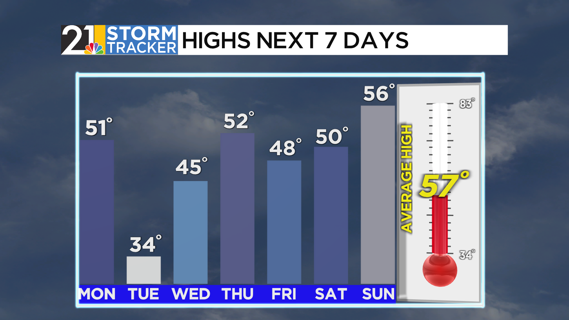
Monday will be quiet for much of the day, with some sunshine possible through early afternoon. A cold front approaching the region this evening will bring a round of rain and snow showers to the valley. Precipitation will start as a period of rain before transitioning to snow as temperatures quickly fall into the low 30s.
Snow showers will taper to a few flurries overnight, with low temperatures in the mid-20s. A few lake-effect flurries will be possible as you head out the door Tuesday morning, but the bigger story tomorrow will be the winter-like temperatures. Highs will struggle to get out of the mid-30s with mostly cloudy skies.
Highs will jump back into the 40s on Wednesday, with high pressure briefly sliding overhead. Our next storm system will move in Wednesday night, bringing another area of rain and snow. Showers will remain likely on Thursday, especially early on.
A shower or two cannot be ruled out on Friday, with temperatures around 50 degrees. The start of next weekend looks more seasonable, with highs back in the mid-50s.


