The umbrella will be your friend as we head towards the weekend

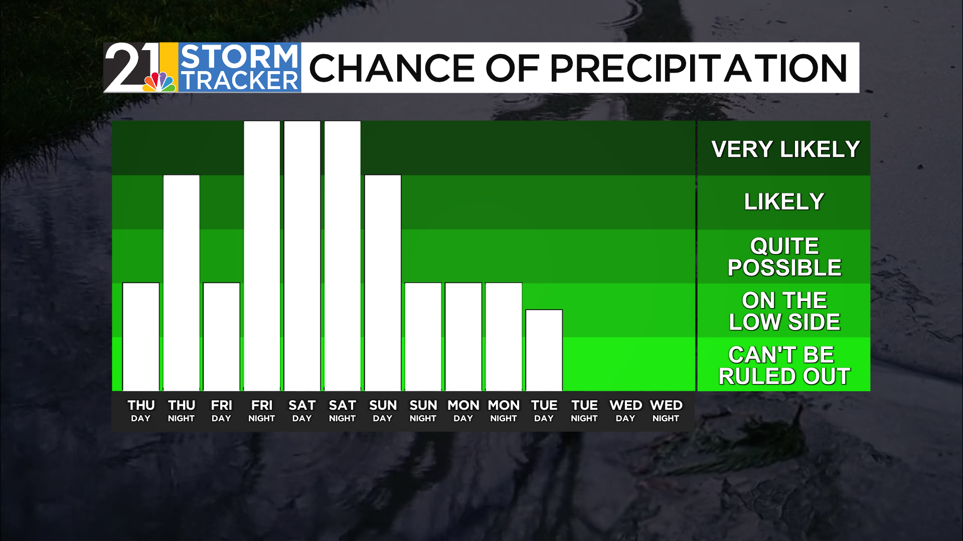
While the main line of showers and storms ended before daybreak, a few showers could still stick around Thursday morning as a cold front passes through the area.
Some filtered sunshine will be possible during the middle of the day with high temperatures nearing 70 degrees. A shower or two could sneak in this evening as another wave of low pressure approaches.
Rain will become likely for a few hours overnight with temperatures falling into the mid-40s. Southern areas will experience the longest-lasting raindrops, while rainfall will decrease for everyone during the Friday morning commute. Mainly cloudy skies will be around Friday afternoon with highs in the upper 50s.
Another round of rain will arrive Friday evening, and the weekend is setting up to be a soggy one. Rain will be likely on Saturday, especially early in the day. Showers will become a bit more scattered during the afternoon, with highs in the upper 60s.
Rain will stick around Saturday night into Sunday, with light rain sticking around for the first part of the day. Colder air will start to move in on Sunday as well with highs only in the mid-40s. A few snowflakes could even start to mix in Sunday night.