Opening day warm up on-deck

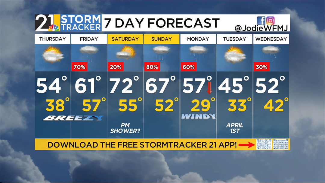
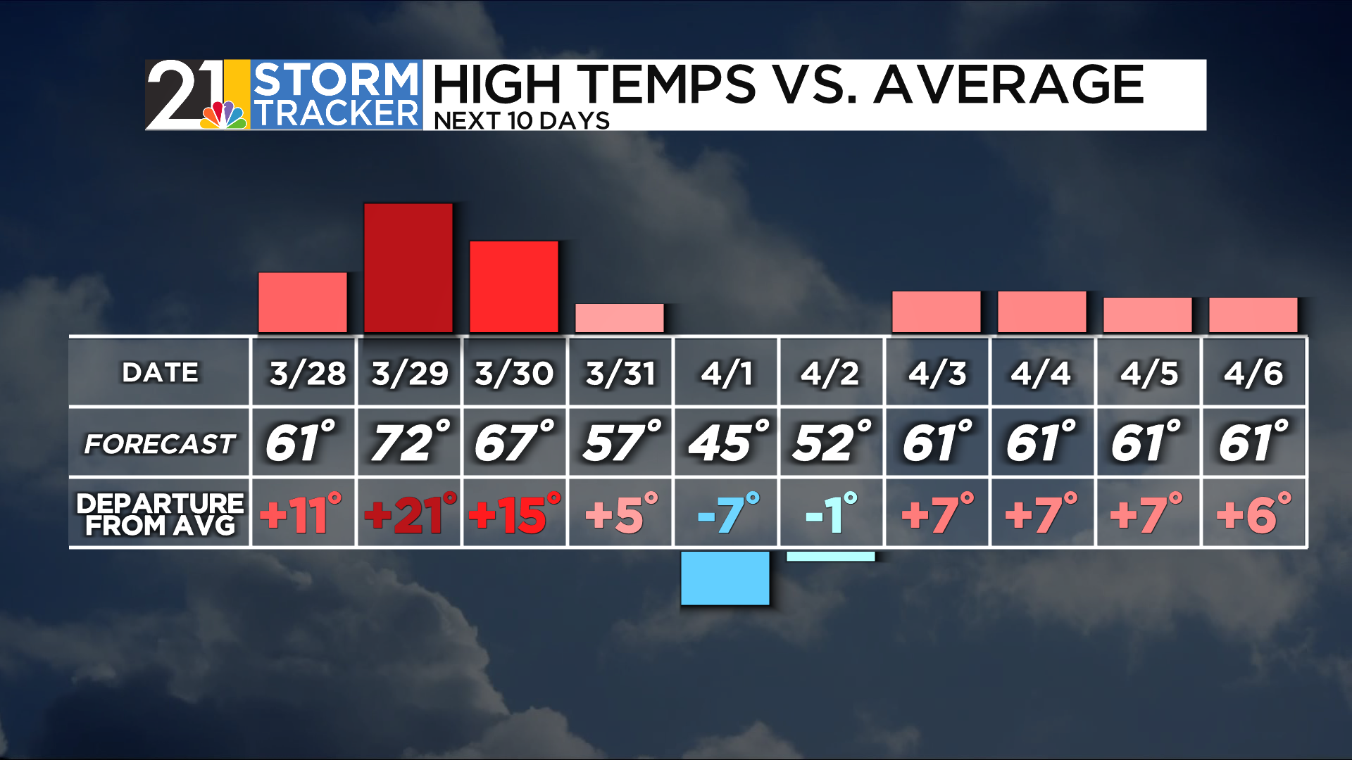
Thursday will be a transitional day into a warmer yet stormy pattern. The 50s, 60s, and 70s are making a comeback to round the bases of March. This morning, we traded yesterday’s snowflakes for frost on the grassy surfaces and rooftops. A cold, bright start will give way to a mild afternoon, with patchy clouds spilling overhead late in the day. Afternoon maximum temps in the low 50s will be found in most neighborhoods.
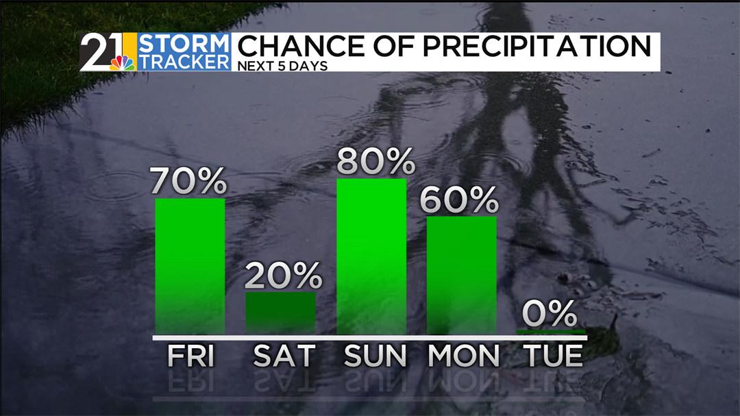
We’ll turn unsettled around here for the weekend. Friday will be noticeably warmer, with raindrops chasing our dry forecast away. Showers will dampen the midday hours and extend into early evening. Be on the lookout for some pretty sunsets Friday night. The showers announce the arrival of balmy temperatures for both Saturday and Sunday. An afternoon shower could wet the landscape Saturday late in the day, but most of the day looks dry and warm - enjoy! On Sunday, a mild and soggy day will be in the cards for brunch and errands.
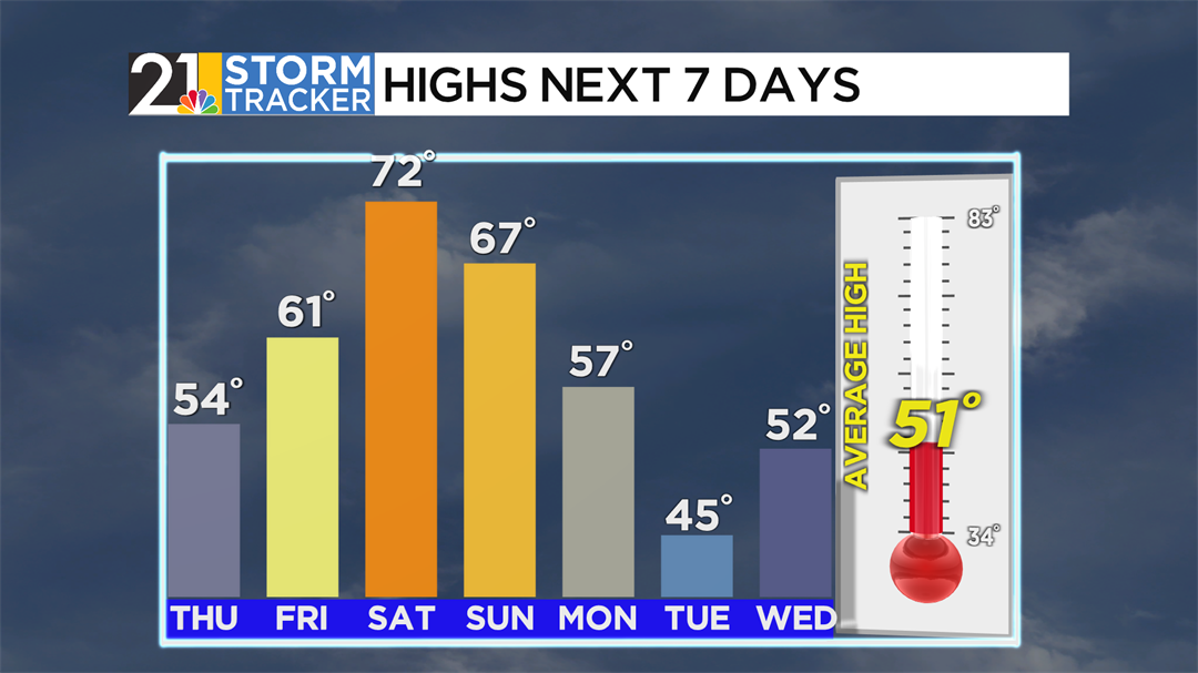
What goes up (temperatures) must go down—temperatures will fall throughout the day on Monday, and we will be back into the 40s on Tuesday, with brilliant sunshine for April 1st.
Join us as we root for spring to spring longer than just a few days: online, on-air, on our social media pages, or wherever you stream. Get the latest forecast daily on WFMJ Today from 5 a.m. - 7 a.m. Download and track the latest developments with the free Storm Tracker 21 app! Get hourly conditions, check the live interactive radar, 7-day forecast, and more. You can also share your weather photos with us through the app!
Here’s a look at your Thursday morning 7-day forecast: