Scattered showers slide in to start the weekend

A cold front approaching the area will lead to the development of some scattered showers Saturday morning. Temperatures will start the day in the mid-40s before falling into the 30s as we head towards midday.
With colder air moving in, precipitation will start to mix with snowflakes, and by the afternoon we will just be left with a few flurries. Any snowflakes will taper off by sunset, and skies will briefly clear out for a time overnight.
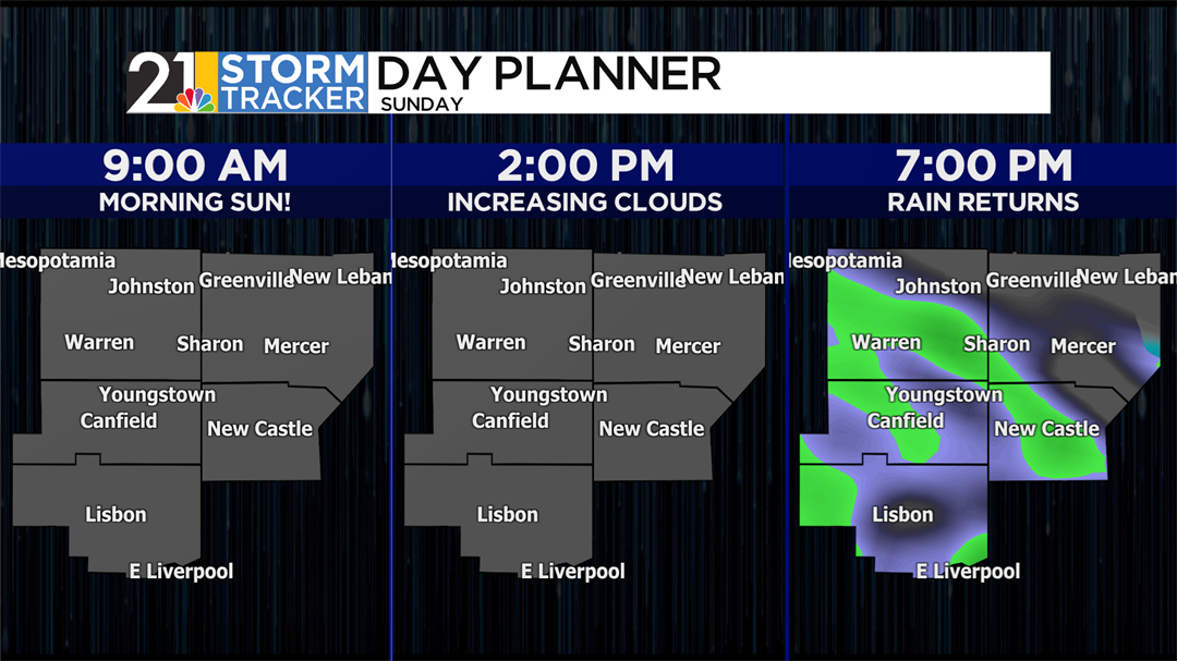
Clouds will build back in Sunday afternoon with high temperatures reaching the upper 40s. Showers will become likely by sunset as an area of low pressure moves through the Great Lakes. Rain will start to taper off by midnight, and only a stray shower or two will be leftover for Monday morning.
A mix of sun and clouds is expected on Tuesday and Wednesday with high temperatures in the mid-40s. Another round of showers could be on the way Friday afternoon and evening.