A bright and seasonable end to the work week

The first day of spring was a gloomy one, with clouds and showers around on Thursday. Today will be a different story with mostly sunny skies expected and high temperatures nearing 50 degrees. Clouds will start to move back in Friday evening, ahead of our next chance of rain early Saturday.
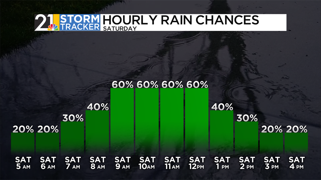
A cold front moving through the region will lead to scattered showers during the first half of the day on Saturday. Temperatures will also peak Saturday morning, before falling throughout the afternoon and evening. The influx of colder air will allow for a few flurries to develop after midday.
Skies will briefly clear out for a time Saturday night before clouds roll back in on Sunday. High temperatures Sunday afternoon will reach the mid-40s and there could be a shower or two before the day is through. Showers will be more likely Sunday night into early Monday morning.
Scattered raindrops will be around at times Monday afternoon with high temperatures back around the 50-degree mark. More chances for sprinkles and showers will be around through the middle of the week, with a few snowflakes possibly mixing in on Tuesday and Wednesday.