Spring surge ahead

Springlike warmth returns for a two-day stag as we countdown to the spring equinox - Thursday, March 20th at 5:01AM.
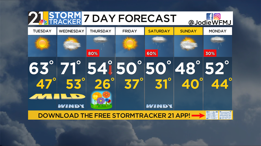
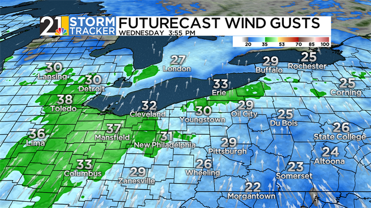
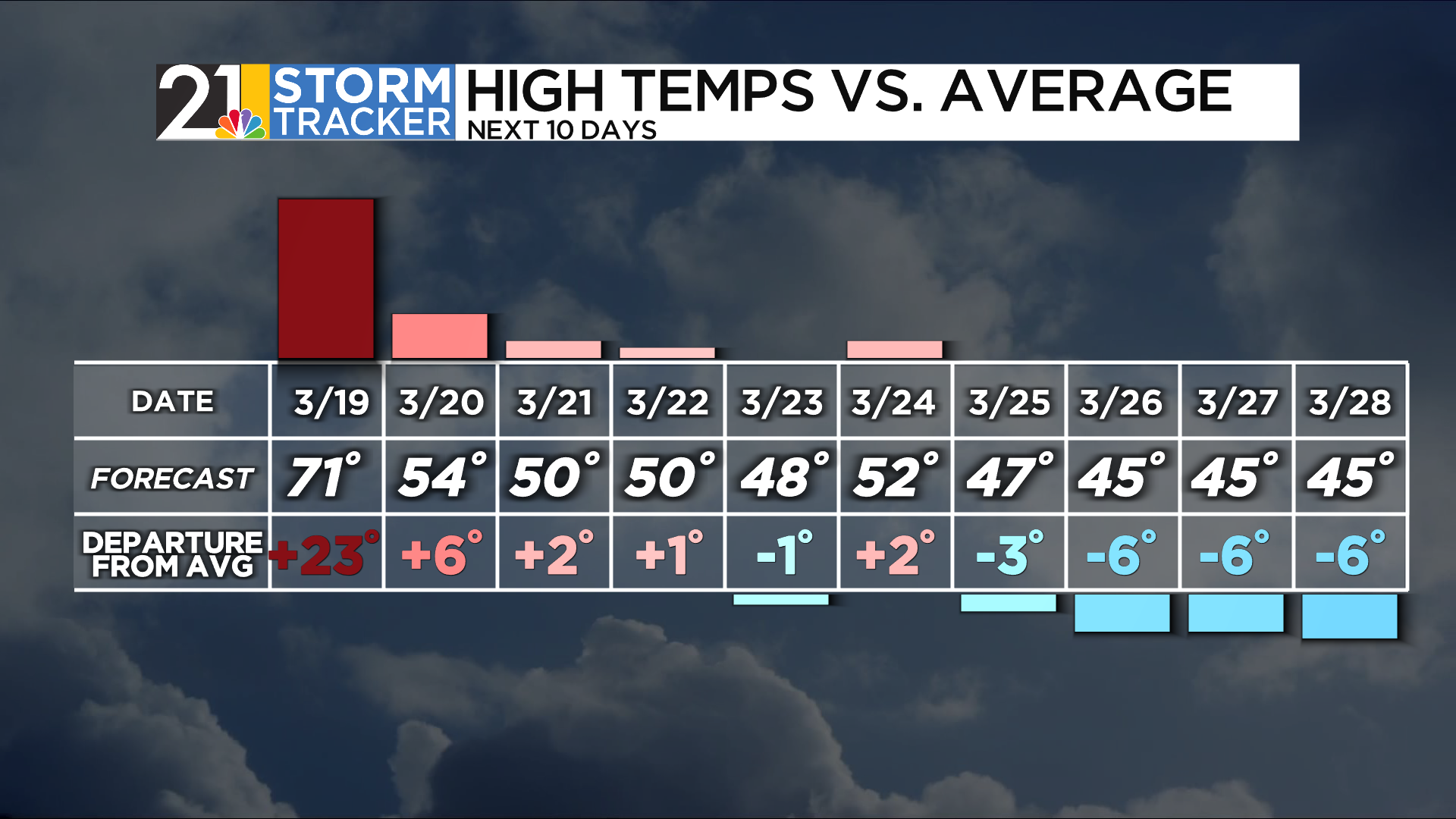
Temperatures will be warm once again with a persistent breeze around. Tuesday we warm into the 60s - in fact, low/middle 60s with wall-to-wall sunshine. Wednesday promises to catapult us back to a 70-degree day with strong southerly winds. Enjoy the warmer temps because it may be a while before we see those readings again. On Wednesday you might be inspired to do more spring yard cleanup, but you may want to hold off on any burning. Winds could gust over 30 mph which could easily spread embers around.
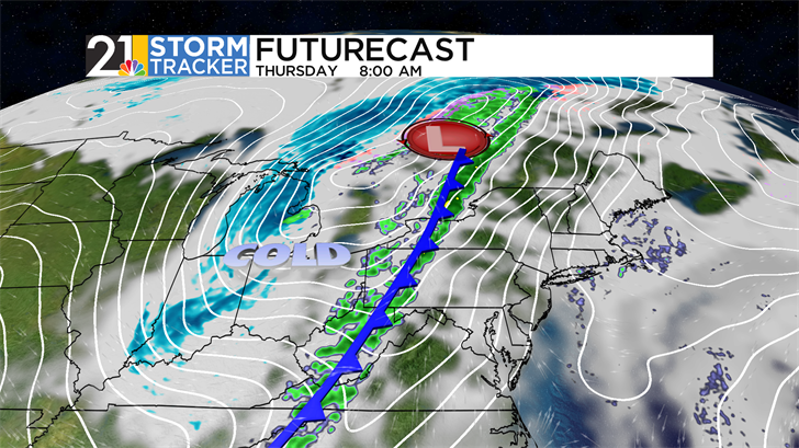
Rain will hold back until late Wednesday night while most sleep into the Thursday morning rush, with a potent cold front that will cool us down for the first day of spring. Gusty winds (occasional surges), sustained wind (the persistent kind), and the cold wind (that creates a feels-like temp) will impact our days by week’s end. There is also a chance some snowflakes could mix in with the rain on the backside of this storm system Thursday night.
Beyond that, the first weekend of spring temperatures will be parked in the 50s - right where we should be for this time of year. A quick hitting system could bring showers around on Saturday. right now, rainfall amounts do not look that impressive at this point, but we will continue to watch.
Join us as we enjoy another spring preview for the last two days of winter: online, on-air, on our social media pages or wherever you stream. Get the latest forecast every morning on WFMJ Today from 5am - 7am. Download and track the latest developments with the free Storm Tracker 21 app! Get hourly conditions, check the live interactive radar, 7-day forecast, and more. Plus, you can share your weather photos with us directly through the app!
Here’s a look at your Tuesday morning 7-day forecast: